- Atherstone Residential Development
- Brisbane Ranges (Archaeological Survey)
- Cato Street Carpark, Prahran
- Connolly Avenue, Pedestrian Bridge, Coburg (CHMP)
- Cullulleraine (CHMP)
- Dargo Aboriginal and Historical Sites Research
- Gisborne-Melton Road, Gisborne (CHMP)
- Gold Rush-era buildings at Burrumbeet
- Green Tent Rd (Historical Site Excavations)
- Lyndhurst (Salvage Excavation)
- Mernda Central P-12 School (CHMP)
- Mount Alexander Aboriginal sites survey
- Old Bridge Inn, Mernda
- Point Cook P-9 School (CHMP)
- Ravenswood Interchange (CHMP)
- The Stork Hotel (Historical Site Excavations)
- Toolern Creek Bridge, Atherstone (CHMP & Salvage Excavations)
- Trawalla Aboriginal excavations
- Wesley Place
Brisbane Ranges (Archaeological Survey)
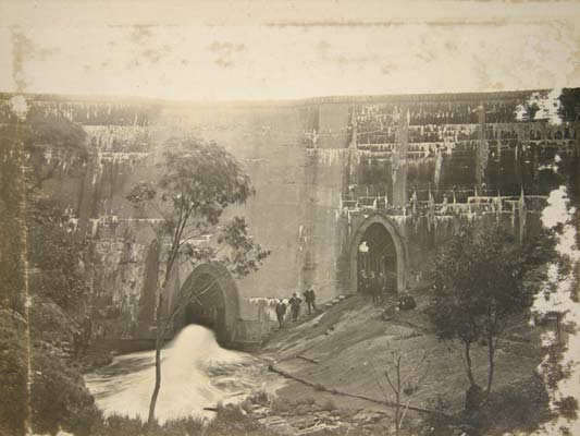
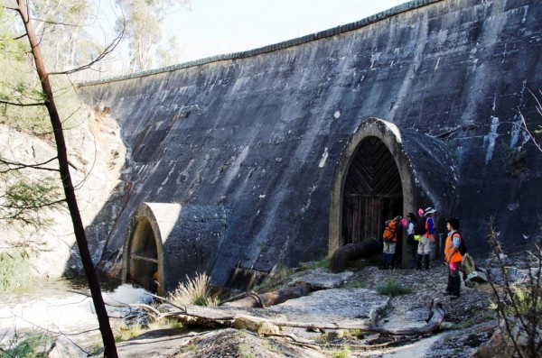
An archaeological survey in 2012 investigated the Lower Stony Creek catchment reserve – an area of 1100 hectares recently added to the Brisbane Ranges National Park. The survey identified 18 previously unrecorded lithic artefact scatters, providing a wealth of new information on past Aboriginal occupation and use of the area. In addition, a submission was written for inclusion of the historic Lower Stony Creek Reservoir dam wall on the Victorian Heritage Register. Recommendations were devised for the protection of identified and unidentified cultural heritage should any future development such as the construction of visitor facilities occur within the park.
Project Manager: | Ben Watson |
Project Type: | Heritage Survey |
Activity: | n/a |
Client: | Parks Victoria |
Date: | May 2012 |
Reference:
Watson, B. 2012. Brisbane Ranges National Park Lower Stony Creek Reservoir Cultural Heritage Survey. Report to Parks Victoria.

Concrete Dam, Lower Stony Creek, Anakie Gorge, c.1910
(Geelong Heritage Service)

Stony Creek Reservoir, Brisbane Ranges National Park, 2012. (B. Watson)